

The fight against land artificialisation, a major axis of the national biodiversity plan
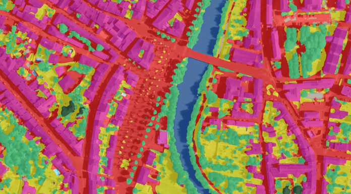
One of the objectives of the government's biodiversity plan is to achieve "zero net artificialisation". This means limiting the consumption of new spaces as much as possible and, when this is impossible, "returning to nature" the equivalent of the areas consumed. It is to meet this challenge that the Observatory of Artificialization of Soil was created in 2019, it also allows everyone to follow the evolution of the consumption of space at the scale of each municipality. Originally based on land files, it is now enriched by the geographic data repository produced by the IGN, in collaboration with CEREMA and INRAE, according to the OCS GE (Large Scale Land Use) nomenclature. This mapping will benefit from a budget of 20 million euros, the DGALN (Directorate of the Ministry of Ecological Transition in charge of Development, Housing and Nature) is the project manager. The objective for IGN is to report on the state of health of forests, the erosion of the relief and the evolution of waterways, the artificialization of soils, the potential of biodiversity and other themes to be defined in support of public policies. Local authorities, start-ups and industrial partners have a role to play in this innovative process.An innovative production process based on AI and deep learning
IGN relies on AI to automate its initial production chains and update geographic data describing land use and occupation, and more specifically on deep learning to automatically recognize objects (buildings, trees, asphalt surfaces, etc.) that contribute to land use classes on aerial or spatial images.Open resources for common enrichment
The IGN is making available in open data all the resources that contribute to the automated process on the geoservices.ign.fr website, which provides access to :- annotations (data used to train deep learning models),
- deep learning datasets,
- AI models and associated computer codes,
- deep learning prediction maps.
The entire French territory covered by 2024
Coverage of metropolitan France and its overseas departments and regions will be achieved by 2024, with the production of two vintages per department. A deep learning model called "France entière" is trained to generate predictions and the OCS GE product on all departments. The departments 35, 33, 62, 69, 67, 72, 77, 83 and 91 are currently being produced, and the intermediate data and products will be available progressively between December 2022 and March 2023, on the geoservices.ign.fr website. Translated from L'IGN mise sur l'IA et le deep dearning pour enrichir les données d'occupation des sols Add ActuIA to my preferred sources on Google
On the Google page, tick the box next to ActuIA: our articles will then appear first in Top Stories.