IGN
IGN, or the Institut national de l'information géographique et forestière, is a major player in the field of geomatics and geographic information in France. This public administrative institution, under the supervision of the Ministry of Ecological and Inclusive Transition, stands out for its expertise in cartography, management, and dissemination of geographic data. Its main mission is to produce and disseminate reference geographic data for the French territory, as well as to contribute to technological innovation in this field.
Read more of the profile Updated on 5 June 2026
Areas of Expertise and Key Achievements
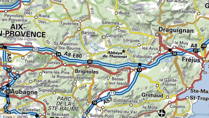
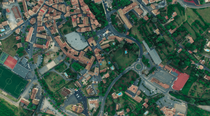
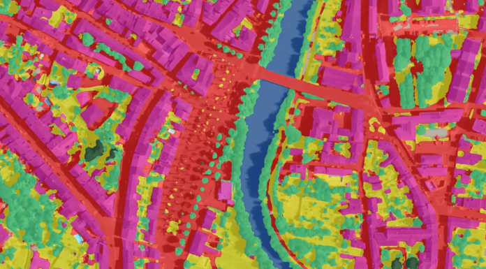
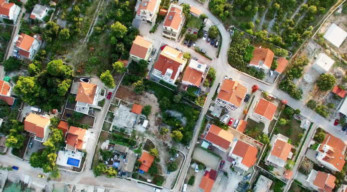
IGN is renowned for its advancements in 3D mapping, remote sensing, and geographic information management. One of its flagship achievements is the LiDAR HD program, launched in 2021. This ambitious project aims to map the entire French territory in three dimensions with unparalleled precision. Thanks to LiDAR technology, IGN can create detailed digital models that are essential for various applications, ranging from forest management to natural risk prevention.
The models produced by the LiDAR HD program include digital surface models (DSM), digital terrain models (DTM), and digital height models (DHM), each having specific applications such as solar potential assessment or flood risk management.
Recent Contributions and Notable Projects
Recently, IGN reached a significant milestone by making available the first 3D models from the LiDAR HD program. This initiative, supported by the State and the European Union, already covers nearly 135,000 km² and is expected to extend to the entire territory by the end of 2026. The collected data is published as open data, allowing wide use by local authorities, companies, and researchers.
IGN also plays a crucial role in the call for commons launched by ADEME in partnership with other organizations. This call aims to mobilize the commons for ecological transition by supporting projects that develop open and reusable resources. Through its Fabrique des GéoCommuns, IGN provides its technical expertise to encourage open innovation in the geospatial field.
Position in the Technological Ecosystem
IGN positions itself as a key player in the French and European technological landscape, significantly contributing to innovation in geographic information. Its commitment to open data and emerging technologies, such as LiDAR, places it at the heart of initiatives aimed at increasing the use of geospatial data for sustainable development.
The institute works closely with other public institutions, companies, and universities, thus fostering an ecosystem where research and innovation can thrive. This collaboration is notably manifested in projects such as ADEME's call for commons, where IGN acts as a facilitator for the use of geographic data in ecological initiatives.
Recent Developments and News
Among recent developments, IGN continues to expand the coverage of its LiDAR HD program, with a goal of covering 80% of the national territory by the end of 2025. The data is accessible via IGN's distribution platform, allowing easy visualization and download for users.
IGN is also active in supporting collaborative innovation, notably through strategic partnerships aimed at enhancing the impact of geospatial projects on society. The institute remains committed to promoting the use of open data to stimulate research, innovation, and informed decision-making in various sectors.
In conclusion, IGN stands out for its leadership in the production and management of geospatial data, its contribution to ecological transition, and its central role in the technological ecosystem. Through its innovative initiatives and ability to collaborate with various stakeholders, IGN continues to shape the future of geographic information in France and beyond.
Related articles
11 in total
Digital sovereignty: CIANum calls for overcoming public-private silos to build strategic commons
Innovating for Ecological Transition: ADEME Launches the 3rd Edition of Its Call for Commons
The first digital models from the LiDAR HD program are available
AI and tax fraud: the first results of the "Innovative Land" scheme
IGN relies on AI and deep learning to enrich land use data

RenovAlte, a Franco-German project based on AI for the energy renovation of buildings
DGFiP: tax audits rely more and more on Artificial Intelligence and data-mining
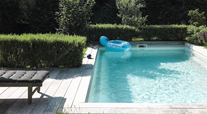
Bouches-du-Rhône and Var: 12,000 undeclared pools detected thanks to Artificial Intelligence

The taxman uses Google to detect undeclared swimming pools

The national Lidar HD programme: 3D mapping of the entire French territory