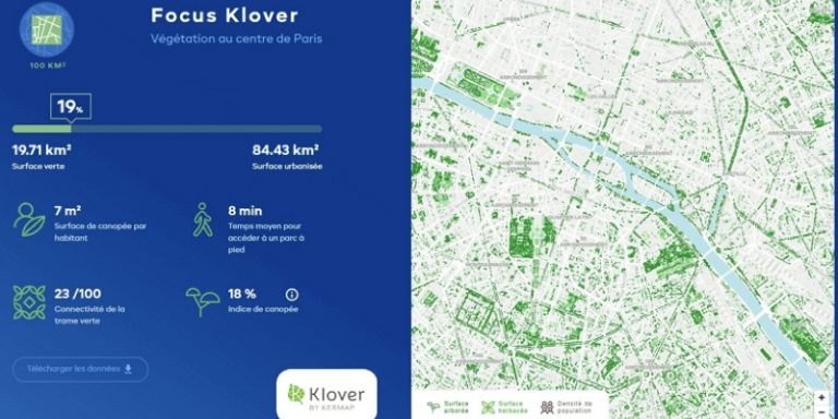
The new Klover platform allows users to explore the vegetation of the world’s major cities, which is essential for combating the effects of climate change. With this online site, which can be consulted at klover.city, Kermap demonstrates how the use and analysis of satellite data can be used to guide territories towards sustainable and resilient development.
Kermap and the geo-intelligence of territories
Kermap, founded in Rennes in 2017, offers geo-intelligence services for territories to public and private players with the aim of simplifying access to geographic data from Earth observation. Its expertise in spatial analysis and automation of image processing by AI, allows it to produce and facilitate the visualization of this information for territorial monitoring and decision support.
Paris lacks the green needed to counter heat waves, it is one of the least vegetated metropolises, and Montreal has the highest temperature increase (+2.2°C by 2021) ahead of Shanghai, Washington and New York. This is the type of information that can be found on klover.city, which puts vegetation data and climate change in 24 world cities into perspective thanks to ranking and comparison functions. Indicators are provided for the last 40 years in order to gain perspective on climate change, as well as daily temperature and rainfall data.
Green in the heart of cities
Using the Airbus Pleiades satellites made available by the French National Centre for Space Studies (CNES), Klover provides a precise description of the vegetation heritage of cities: canopy surface, access time to a park, ecological continuity, etc.
Artificial intelligence processes developed by Kermap have made it possible to map the vegetation in each city and to extract advanced indicators on their green mesh. These data are freely available.
Urban vegetation as a solution to climate change
If 55% of the world’s inhabitants are urban, they will be 68% in 2050. The world’s metropolises will therefore have to adapt to cope with climate change and its consequences (increased frequency and intensity of extreme events). This challenge can be met through the key role of urban vegetation and its multiple ecosystem benefits: lower temperatures, preservation of biodiversity, improved air quality and quality of life, etc. The resilience of urban environments could well lie in the greening of cities. Hence Klover’s project to provide information on the role of vegetation and its crucial role in adapting cities to the climate emergency.
Spatial imagery, a powerful tool
For four years, the Rennes-based startup has been deploying its expertise in satellite and aerial image processing to support public and private players in the ecological transition.
To illustrate the concrete contribution of its AI methods and visualization tools, Kermap has produced a complete map of the tree population in mainland France, freely available on the Nos Villes Vertes platform, as well as a map of agricultural crops in 11 European countries via Nimbo.
For Klover, raising awareness of the climate problems of large urban centres and the valuable contribution of space imagery requires the accessibility of data from Earth observation.
Translated from Kermap présente Klover, un observatoire sur la place de la végétation et l’impact du changement climatique


